
This short article is based on William Petty’s map of Wexford of 1685 and its depiction of Bree. As well as detailing a number of place-names within the parish the map also shows the location of buildings such as castles, churches and mills. Sir William Petty, the author of the map, was an English economist, scientist and philosopher, who came to prominence serving under Oliver Cromwell. He was a noted cartographer and produced a series of maps in Ireland that were mainly used to redistribute confiscated land to Cromwell’s soldiers and supporters.
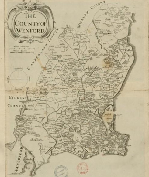
On his map of Wexford the three medieval parishes of Ballikeoge (Ballyhogue), Clonemore (Clonmore) and Kilcoman (Kilcowanmore), which make up the modern parish of Bree are clearly shown, as is the boundary that divides the baronies of Bantry and Shelmalier. A series of mounds are also illustrated near the centre of the parish and these are undoubtedly artistic representations of Bree and Raheenahoon hills (see image below).
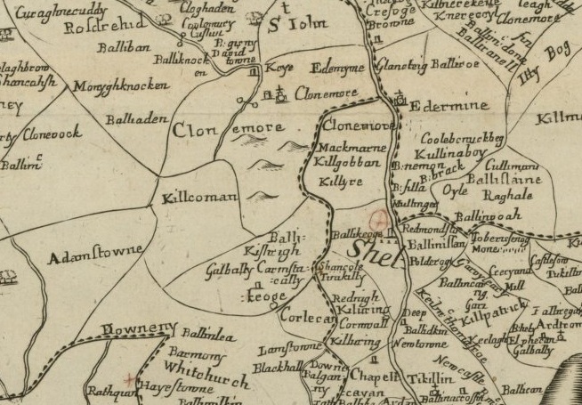
Castles or towerhouses are shown at Keye (Wilton), Ballikeoge (Ballyhogue), Clonemore (Clonmore/Bree) and Galbally. The castle at Wilton is well known and a fortification is recorded here since at least 1374[i], with the Civil Survey of 1654 describing it as a ‘fayre castle, with diverse houses and offices, a good water mill and a coneyborough’[ii]. The towerhouse shown at Ballyhogue is also illustrated in the earlier Down Survey Map of 1656 and it may have been built by the Knights Hospitallers. These were a religious order of knights who were in possession of Ballyhogue for most of the medieval period. The castle at Clonmore probably corresponds to large house which is shown in the vicinity of Bree village on the earlier Down Survey map (1656), while the castle illustrated near Galbally is slightly puzzling as there are no other historic references to this building. Somewhat surprisingly neither the castle at Macmine nor the castle that formerly stood at Ballybrennan are shown on this map.

Other buildings illustrated include the church at Clonmore and a mill along the River Boro (two circles joined by a line). Interestingly an number of place-names in the parish are also recorded on this map including
Keye (Kayer) =Wilton
Edermyne=Borrmont
Mackmarne=Mackmine
Killgobban=Killgibbon
Killyre=this townland no longer exits but was originally located beside Knockduff
Clonemore=Clonmore
Kilcoman (Kilcowanmore)=Ballybrennan
Ballikeoge=Ballyhogue
Galbally=Galbally
Carnstacally=Garrenstackle
Balli-kishrigh=possibly Kereight
Barmony=Barmoney

[i] Circle: A Calendar of Chancery Letters 1244-1509; Patent Roll 48 Edward III, 13 Dec. 1374 URL: http://chancery.tcd.ie/document/patent/48-edward-iii/10?view=chancery_advanced_search&display=search_persons_or_page&path=search-persons-text&surnametext=Furlong&surname=Furlong&forename=Furlong&titlestatus=Furlong&office=Furlong Date Accessed 23 April 2012
[ii] Simington, R. C. The Civil Survey 1654-1656 Vol. IX County Wexford. Dublin
